
Scale drawings and map scales
A scale drawing shows a real object bigger or smaller, with every length changed by the same scale. Use the scale to find real and drawing lengths.
The idea: every length changes the same way
A map, a floor plan and a model car are scale drawings. Every length on the drawing matches a real length by the same ratio, called the scale.
A scale like 1 cm : 5 km means each centimetre on the map stands for 5 kilometres in real life. A scale is just a ratio, so ratio tables and proportions work here too.
See it: pictures to draw with your child
Copy these onto paper or a whiteboard. A quick sketch makes the idea concrete before any written method.
From the drawing to real life
Measure the drawing, then multiply by the scale. On a map with 1 cm : 5 km, two towns 7 cm apart are 7 × 5 = 35 km apart.
A ratio table makes it clear: 1 cm is 5 km, 2 cm is 10 km and 7 cm is 35 km.
From real life to the drawing
Divide the real length by the scale. On a plan where 1 inch stands for 4 feet, a 20-foot wall is 20 ÷ 4 = 5 inches long.
Always check the units. If the scale is 1 cm : 2 m and the room is 750 cm long, change it to 7.5 m first.
Solve a scale problem
Write the scale on the left and the length you know on the right. Leave the missing length empty.
Scale factors
A scale factor tells you what to multiply every length by. A scale factor of 3 makes a copy three times as long and three times as wide. A scale factor of 1/2 halves every length.
Area changes by the square of the scale factor. Doubling the sides of a rectangle makes its area 2 × 2 = 4 times as big, not twice as big.
Scales written without units
Maps often show a scale like 1 : 50,000. That means 1 unit on the map is 50,000 of the same units in real life. So 1 cm is 50,000 cm, which is 500 m.
Change big numbers to sensible units at the end. 4 cm on this map is 200,000 cm, which is 2 km.
Quiz: scale drawings
Use the scale or the scale factor to find the length.
Where this fits: ratios step by step
- What is a ratio
- Part-to-part and part-to-whole ratios
- Equivalent ratios
- Simplifying ratios
- Ratio tables
- Double number lines
- Tape diagrams
- Comparing ratios
- Unit rates
- Unit price and best buy
- Speed, distance and time
- Solving proportions
- Proportional relationships
- Constant of proportionality
- Scale drawings and maps (this page)
- Ratio word problems
What to say to your child
A short script for teaching it the first time. Pause after each line and let your child do the next step.
- “On this map, 1 cm is 5 km. Two towns are 7 cm apart. How far really?” (35 km.)
- “How did you work it out?” (7 times 5.)
- “A real road is 20 km. How long on the map?” (4 cm.)
- “If we double a drawing, what happens to each side?” (It doubles.)
- “And the area?” (It gets 4 times bigger.)
More worked examples
Example 1: map to real
1 cm : 20 km. A river is 6.5 cm long on the map. 6.5 × 20 = 130 km.
Example 2: real to plan
1 in : 8 ft. A garden is 40 ft long. 40 ÷ 8 = 5 in on the plan.
Example 3: scale factor
A 6 cm by 4 cm photo is enlarged by a scale factor of 2.5. The new size is 15 cm by 10 cm.
Example 4: ratio scale
Scale 1 : 25,000. 8 cm on the map is 200,000 cm = 2,000 m = 2 km.
Practice questions (answers below)
Ask these out loud or write them down. Check each answer, and ask “how did you get that?” for one or two.
- 1 cm : 10 km. 4 cm is?
- 1 cm : 5 km. 9 cm is?
- 1 in : 4 ft. A 24 ft wall on the plan?
- 1 cm : 2 m. A 13 m room on the plan?
- Scale factor 3. A 5 cm side becomes?
- Scale factor 1/2. A 12 cm side becomes?
- Scale factor 2. Area 10 cm² becomes?
- 1 : 100. 3 cm is how many metres?
- A 2 cm model of a 6 m car. Scale?
- Stretch: 1 : 50,000. How many cm on the map for 4 km?
Show the answers
- 40 km
- 45 km
- 6 in
- 6.5 cm
- 15 cm
- 6 cm
- 40 cm²
- 3 m
- 1 : 300
- 8 cm
Common mistakes
How to teach it at home
Room plan
Measure a room and draw it with 1 cm for 50 cm.
Map hunt
Use a map scale to find the distance to a friend’s house or a park.
Toy scale
Find the scale of a model car, like 1 : 43, and work out the real length.
By grade
- Grade 7 (7.G.A.1): solve problems with scale drawings, real lengths and areas.
- Grade 7 (7.RP.A.2): a scale is a proportional relationship.
- In India, map scales appear in class 7 maths and geography.
- Next: ratio word problems.
More for each grade: Grade 7 math and the CBSE class 7 maths guide.
Worksheets and practice
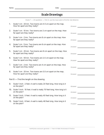
Scale drawings worksheet: printable PDF with an answer key. · Make a fresh test
Ratio practice · ratio calculator · unit rate calculator · ratio games · ratios for kids · percentages
Last reviewed
Questions parents ask
What is a scale drawing?
A drawing of a real object where every length is changed by the same ratio, like a map or a floor plan.
How do you use a map scale?
Measure the map distance and multiply by the scale. At 1 cm : 5 km, 7 cm is 35 km.
How do you find a length on a scale drawing?
Divide the real length by the scale. At 1 in : 4 ft, a 20 ft wall is 5 inches.
What is a scale factor?
The number every length is multiplied by. A scale factor of 2 doubles every length.
What grade learns scale drawings?
Grade 7 under Common Core 7.G.A.1. In India, class 7.